From Ore to Outcome
From Exploration to Reclamation – Geospatial Solutions that Deliver
Optimize across the mining lifecycle with EarthDaily’s geospatial intelligence solutions. Accelerate exploration, monitor infrastructure and resource risk, track reclamation efforts, and manage stakeholders with industry-leading remote sensing technology.

Rapidly analyze remote sensing data to identify potential mineral deposits.
Reduce exploration costs by integrating multi-sensor satellite imagery with geospatial analysis.
Increase confidence in early-stage assessments by leveraging historical and near-real-time datasets.
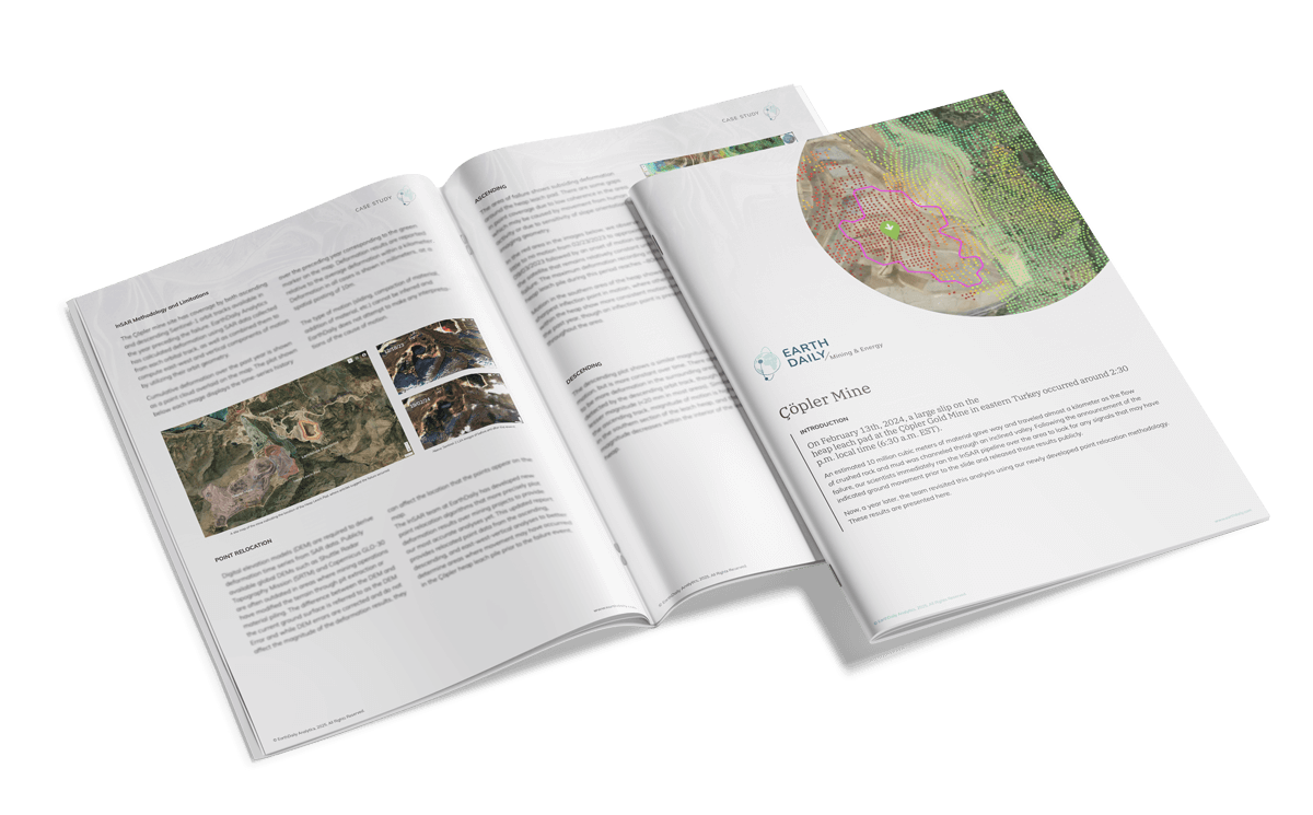
Detect and track ground movement using InSAR deformation analysis.
Monitor tailings dams, heap leach pads, and underground mines for early signs of instability.
Improve risk assessment with automated anomaly detection and trend analysis.